Plan2Fly offers tools to plan, manage and execute drone missions.
As a certified drone pilot, we expect you to be in aware of applicable legislation and reservations in this regard. We will not go into more details about the legislation itself in this FAQ, but instead we will focus on providing an insight into our functions and tools as well as areas that may be of importance to your use of Plan2Fly.
If you need a refresher on rules and legislation, you can read more at your local authority.
Plan2Fly is for you who want to be well prepared before your drone flights – whether you need to check flight zones, measure distances or a system to manage and keep track of multiple missions at the same time.
The platform gives you all the necessary tools to plan drone missions, so you can concentrate on what you do best – flying.
Errors
If you experience errors or problems on the platform, we would very much like to hear from you. Our tech team is constantly working to improve the experience and develop new features – and here we need your input.
Send us an email at support@plan2fly.com with a description of the error and when/how it occurred. If you have a screen shot or a screen recording that you can attach, it will be of big help.
Price
Right now there is a unique opportunity to use all functions in Plan2Fly completely free of charge. In the long term, “share mission” and future features will be associated with a subscription solution. However, there will always be a free version available as well.
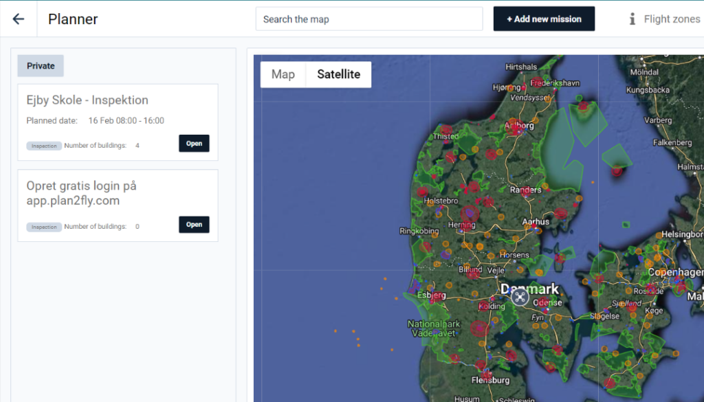
In the planning tool, you can keep an overview of all your planned missions, which are displayed in a long list. You can click on each mission to read the brief etc. and to change in the mission.
Click on “mission planner” in the menu on the left side to get to the list with all your missions.
The map
You find your desired location by entering the address in the search function at the top of the map. On the map, you can zoom in and out, just as you can drag the map with the mouse to change location.
Add mission
When you have found your desired location on the map, you then click on “add new mission” before creating a new mission. You can now name the mission, choose a time slot on the calendar where the mission must be carried out and write a brief.
You can then use the planning tools described below.
Zones
On the map, you can see the various zones that may influence where you may fly and whether special rules apply in the area. In the top menu, you can switch the zones on and off, depending on which and how many zones you want to be displayed. By default, all zones are switched on.
Share mission
With a single click, you can share your mission with, for example, customers, authorities or business partners. By clicking the “share mission” button, you create a unique URL that can be inserted into an email.
Insert a safety zone into your missions so that you are sure that all precautions are taken. Select the safety zone (H) in the right side tools bar, place it by clicking on the map, and adjust the diameter of the safety zone as needed by selecting the hand tool, clicking on the safety zone and then on the arrows. Tap the trash can to delete the zone.
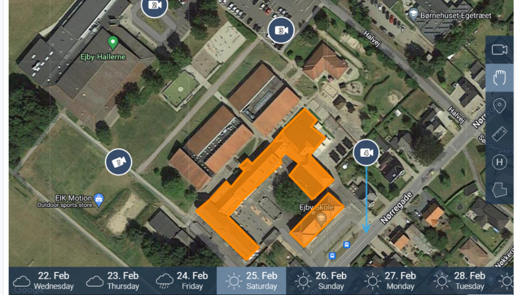
Polygons
You can draw a polygon to mark an area or building in your mission. Select the polygon tool on the right and click on the map where you want to mark. The polygon is completed when the end and start of the line meet.
Use the polygon to measure the size of an area or the footprint of a building. The polygon shows the number of m2 and can therefore be used for any tendering.
Measure tool
With the measuring tool, you can measure distances to buildings, roads or rails. In this way, you are sure that you comply with rules and legislation and can fly safely. The measuring tool can be found by the ruler on the right side of the screen.
Shot list
Add a shot list or shot list to your mission so you’re sure to get it all. Select the video icon on the right side and click on the small pin to place the “shot” on the map with one click. Each shot can be named and have a description.
On the left side under the mission description, you can see a comprehensive list of your planned drone shots.
A shot list can also be used to visualize to a client how you intend to perform the task.
Weather
At the bottom of the map you will find the weather forecast for the coming period. When you plan your mission, you can see when it is best to carry out the flight in relation to wind and weather.
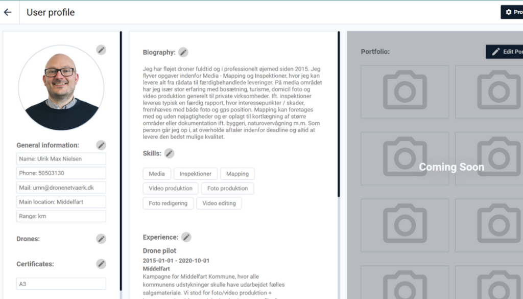
In your profile, you can enter your equipment under the field “drones”. You can add your different models to the drop down list and enter the drone’s registration number
Under “certificates” you can note which certificates you have and when these were obtained.
Experience
Under “skills” you can add your specific competences. It could, for example, be surveying, mapping, thermography, etc.
Under “experience” it is possible to highlight certain jobs or cases you have carried out.
In near future you can share your Plan2Fly profile as an online resume.
Delete profile
If you want to delete your user on Plan2Fly, simply send an email to support@plan2fly.com and we will fix it quickly.
This website uses cookies to improve your experience while you navigate through the website. Out of these, the cookies that are categorized as necessary are stored on your browser as they are essential for the working of basic functionalities of the website. We also use third-party cookies that help us analyze and understand how you use this website. These cookies will be stored in your browser only with your consent. You also have the option to opt-out of these cookies. But opting out of some of these cookies may affect your browsing experience.